Lesson · Grade 8 · Science
Megathrust Earthquakes and Tsunamis: How Cascadia Snapped in 1700
- Grade 8
- Science
- 1 min 57 s
- British Columbia
- BC8-SC-42
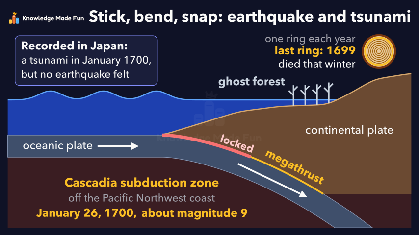
One cross-section builds up step by step. An oceanic plate sinks beneath a continental plate, friction locks the megathrust between them, and for centuries the upper plate's edge is dragged down while the land behind bulges up. Then it snaps back, lifting the sea floor and sending out a tsunami that turns out to be a series of waves, not one giant wave. The Cascadia subduction zone is the example, and its January 26, 1700 earthquake of about magnitude 9 is dated only from geological and written evidence: drowned ghost forests whose last tree ring grew in 1699, and a tsunami recorded in Japan with no earthquake felt there.
Concept: Megathrust earthquakes and tsunamis at a subduction zone
Anyone can watch two lessons on the website without an account. Signing in is free, no payment and no card, and opens three a day; Plus has no limit.
Loading
In one sentence
The question this lesson answers
What causes the strongest earthquakes, and the huge sea waves called tsunamis?
Earth's outer shell is split into tectonic plates. Here, an oceanic plate meets a continental plate.
Transcript
What the lesson says
What causes the strongest earthquakes, and the huge sea waves called tsunamis?
Earth's outer shell is split into tectonic plates. Here, an oceanic plate meets a continental plate.
The denser oceanic plate sinks beneath the continental plate. This is a subduction zone.
The sloping fault between the plates is the megathrust. Friction locks it, so they stick.
For centuries, the sinking plate drags the upper plate's edge down, and the land behind bulges up.
Suddenly the plates slip. The edge snaps up and the land behind drops: a megathrust earthquake.
The sea floor lifts the water above, which spreads out as a tsunami, toward the coast and across the ocean.
A tsunami is not one giant wave, but a series of waves that can keep coming for hours.
A real example is the Cascadia subduction zone, off the Pacific Northwest coast.
Its last great earthquake struck in January 1700. How do we know?
Before 1700, forests grew on the raised coast. The earthquake dropped it, and sea water killed them: ghost forests.
Trees grow one ring each year. Their last ring grew in 1699, so they died that winter.
Across the Pacific, villages in Japan recorded a tsunami in January 1700, but felt no earthquake.
Its timing gives January 26, 1700, and its height gives a magnitude, or size, of about 9.
Plates stick and bend for centuries, then snap: a megathrust earthquake and a tsunami.
Curriculum
Where this fits
- British Columbia, Grade 8
Science, Earth science: major geological events of local significanceBC8-SC-42
Previous: Why Earthquakes and Volcanoes Happen at Plate EdgesNext: Layers of the Earth: Crust, Mantle, Outer Core and Inner Core
The outcomes and strands follow the British Columbia curriculum.
Keep going
 1 min 43 s
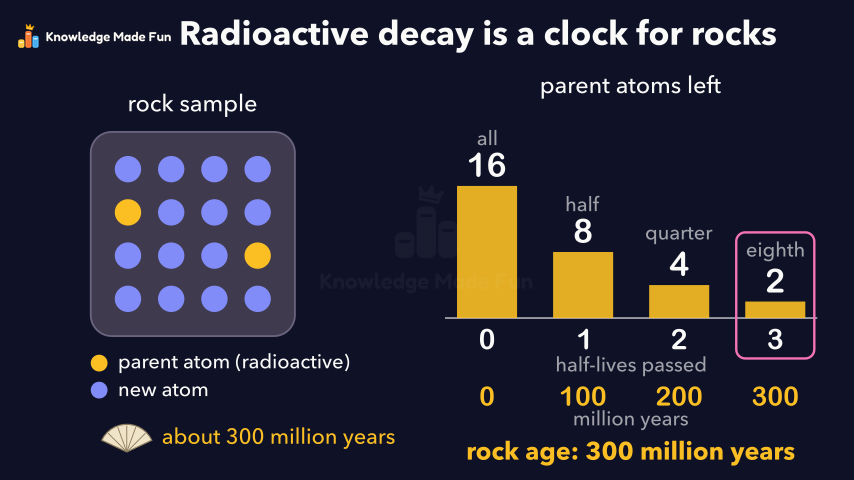
Absolute dating: radioactive decay is a clock for rocks
Grade 7 · 1 min 43 s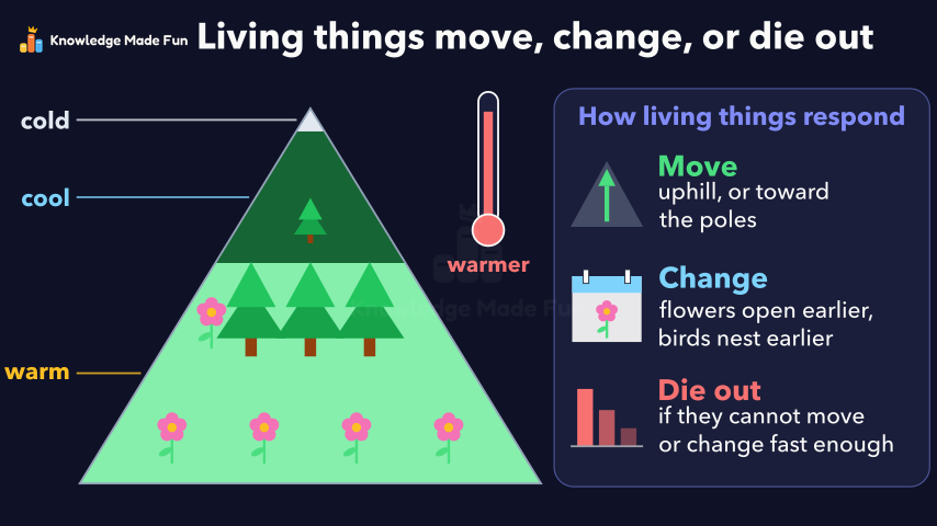 1 min 19 s
Climate Change and Living Things: Move, Change, or Die Out
Grade 7 · 1 min 19 s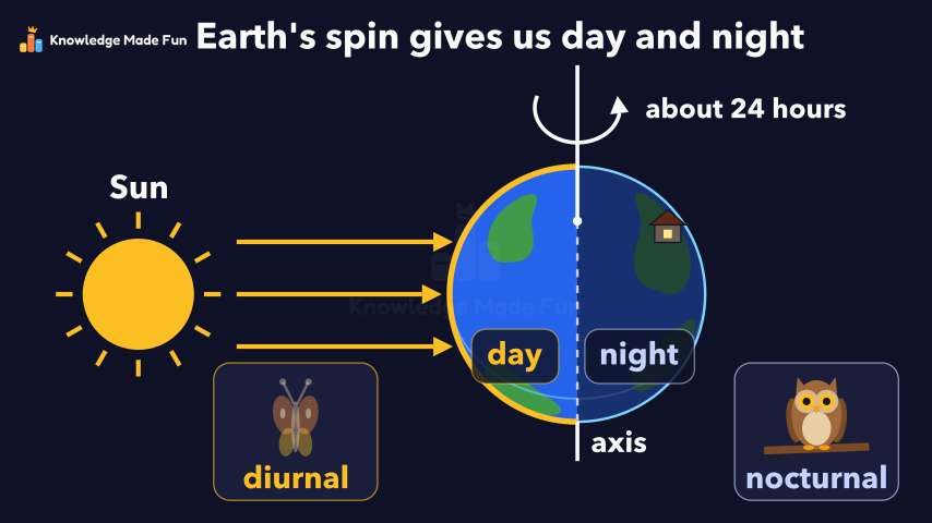 1 min 14 s
Day and Night: Earth Spins on Its Axis
Grade 4 · 1 min 14 s 1 min 50 s
Dynamic equilibrium: balanced but always changing
Grade 9 · 1 min 50 s 1 min 11 s
Earth Materials: From Boulders to Clay
Grade 5 · 1 min 11 s 1 min 11 s
Erosion and Deposition: How Wind, Water and Ice Move Land
Grade 3 · 1 min 11 s 1 min 53 s
From quarks to galaxies: how the universe's matter formed
Grade 10 · 1 min 53 s 47 s
Hot, Warm, Cool and Cold: What Do We Wear?
Kindergarten · 47 s
- All Grade 8 Science lessons
- Create a free account to watch three lessons a day, no payment and no card.